

Mount Lenana
- Kenya -
“The best view comes after the hardest climb”
— Alia K.

Figure 1. Tyndall Glacier Retreat. A. 1992, B. 1997 and C. 2002. ©Prinz et al. 2011.
One of the highlights of my stay in Kenya was scaling Mount Kenya, the highest peak in Kenya and the second-highest peak in Africa after Kilimanjaro. The mountain lies east of the Great Rift Valley, about 175km from Nairobi, and is one of the few places in the world with glaciers at the equator. Mount Kenya is a stratovolcano of geologic origin, formed about three million years ago after the opening of the Great Rift Valley. Initially, the mountain rose above 6000m, but heavy glaciation over thousands of years eroded the volcano, leaving numerous slopes and a multitude of imposing spires, cliffs, complex ridges, and peaks radiating from the centre. Eleven small glaciers remain on the mountain, but these are receding fast due to climate change. Recent predictions by the Intergovernmental Panel on Climate Change suggest that Mount Kenya's equatorial glaciers will disappear completely by 2050. Because Mount Kenya is a key water tower that supplies about 50% of the country’s freshwater and 70% of its hydroelectric power, the future of water security remains uncertain. For this reason, sustainable and renewable initiatives such as hydroponics, geothermal, and solar energy must be encouraged, as these technologies have huge potential in Kenya. The country lies at the equator, where solar radiation is highest on the planet, making solar energy likely the best option, along with geothermal energy from the Rift Valley, to secure Kenya’s energy.
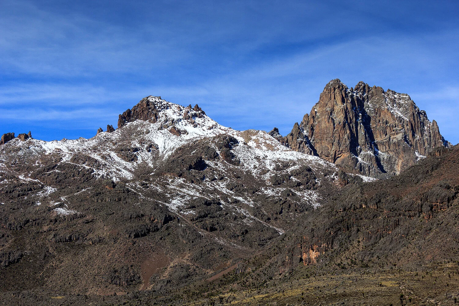
Figure 2. Eastern side of Mountain Kenya. ©Sergiu Jiduc, 2014
Several vegetation bands descend from peak to base, with many endemic plant and animal species, such as giant lobelias and specious, and a local subspecies of rock hyrax. An area of 715km2 around the mountain was designated a national park in 1949 and a UNESCO World Heritage Site in 1997. Several ethnic groups inhabit the mountain's slopes, including the Embu, Ameru Kikuyu, and the famous Maasai. Some of these tribes believe the mountain is sacred and build their houses facing it, with doors on the side nearest to it. Fertile farmland surrounds the base of the mountain. The tribes living around the mountain have cultivated this cool, relatively humid area for centuries, with potatoes, coffee, and tea as the most popular crops.
The main summits are the twins Batian (5199m) and Nelion (5188m), which can only be reached by technical climbing via a variety of rock or ice routes. The third highest peak, Point Lenana (4985m), is a popular destination for advanced trekking parties. Point John (4883m) and some of the other subsidiary peaks also offer good rock-climbing routes. Most of these rock gendarmes are composed of syenite, a rough rock that is perfect for climbing.
Crossing Mount Kenya from West to East
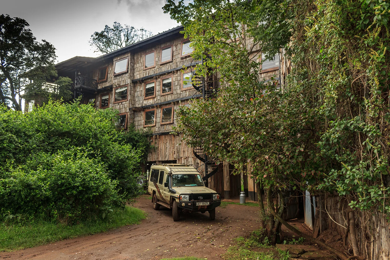
Figure 3. Our ‘ride’ to the gates of Mount Kenya. ©Sergiu Jiduc, 2014
Our adventure began at the Tea Room Matatu stand in central Nairobi. Henrik Huber (a chap from Denmark currently interning at the Growth Africa Business Incubation Centre) and I met at the chaotic bus station where Nairobians depart for destinations across the country. Our destination was Naro Moru, located at the base of the western slopes of Mount Kenya, some 170km from Nairobi. Fully packed with camping, trekking, and cooking equipment, we carefully navigated the large crowds and chose a matatu that looked safe, although safe is probably not a common characteristic of these wrecked public transportation vehicles.

Figure 4. Buffalo visits our camp. ©Sergiu Jiduc, 2014
The journey from Nairobi to Naro Moru took a long three and a half hours on Kenya's wild tarmac roads. Being cramped in the small seven-seater with six other people, not including Henrik, was an unpleasant experience. Nevertheless, we got through it safely and reached Naro Moru just before the torrential rain started pouring down. Naro Moru is a small market town, lying on the Naro Moru River, between Nyeri and Nanyuki. The settlement's main industry is tourism, and it is one of the main bases for hikers ascending Mount Kenya to the east. Here, we rented equipment and a 4x4 Land Rover from the Kenya Wildlife Service to take us to the park gate, situated 17km from Naro Moru. To our surprise, the driver of the Land Rover was the one and only Kim, who accompanied us several days ago to Aberdare National Park, situated not far from Mount Kenya. We were all happy to learn that destiny had brought us together again. I knew we were in safe hands with Kim after witnessing his superb driving skills on the terrible dirt tracks of Aberdare. Kim drove us to pass the park gate (2400m), through a splendid forest for another 9km until we reached the Meteorological Station (3050m), the road ahead for vehicles.
We camped near the edge of the forest in open grassland for the night. Several buffalo were intrigued by our presence but did not dare approach us and continued to graze peacefully. Dinner was a great feast in this wild environment: noodle soup, chorizo, and pesto pasta. The night felt very sinister because of the numerous sounds coming from the forest; I wasn't familiar with most of them.
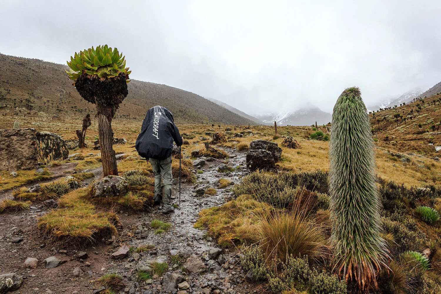
Figure 5. Teleki Valley. ©Sergiu Jiduc, 2014
The next day we left the Meteorological Station early in the morning and continued through the forest until we reached the swampy, muddy section of the route known as the Vertical Bog. As soon as we reached this unpleasant section, the rain began, which continued without stopping for the rest of the day. The ascent via the Teleki Valley to Mackinder Hut (4300m) in this humid environment was quite unpleasant, and occasionally, while crossing the Naro Moru stream, it felt like swimming rather than climbing. It is fair to say that when we reached Mackinder’s hut, some six hours after leaving the Met Station, we were soaking wet. Everything was wet, including our clothes and sleeping bag inside the rucksack.
For hours we tried to make a fire in the hut's fireplace, but unfortunately, the wet logs proved to be quite an inefficient fuel. Eventually, our efforts paid off and the fire kicked in, allowing us to warm up and dry our clothes. Two park rangers visited in the evening and charged us a decent fare for using the hut's basic facilities. Dinner and bed came early that night as we had a big ascent very early the next morning.

Figure 6. Batian and Nelion, the technical peaks of Mount Kenya. ©Sergiu Jiduc, 2014
We left Mackinder Hut around 4 am and began navigating the confusing paths of Teleki Valley. Fortunately, the early morning walk was pleasant, as the boggy areas were frozen. The route took us to the Ranger’s Post with a radio mast beside it, from which it diverged. At least three routes led to the top of Point Lenana, and we hoped to follow the fastest. This proved a difficult mission: the paths were unclear, there were no markers, and my colleague, Henrik, had left his torch in Nairobi, making our ascent hard in the pitch black of the night. After wandering for two hours through boggy terrain, terminal moraines, and other periglacial features, we finally found the correct path to Top Hut, also known as Austrian Hut (4790m). We made a small detour that led to some dangerous downclimbing, but we were finally back on track.

Figure 7. Point Lenana (right hand-side). ©Sergiu Jiduc, 2014
The ascent to Top Tarn (4490m), a lake about 200m below the snout of Lewis Glacier (the largest glacier on Mount Kenya), was tiring because of the steep, unstable scree slope. Moreover, I began to feel sick to my stomach, which I believe was from the chorizo pasta. We reached the Austrian Hut around 9:30 in the morning and had breakfast in this magnificent “nest in the clouds” guarded jaw-dropping rock citadels. We were both tired from carrying the heavy bags up here but too close to the summit to give up. The last 200m to the summit of Point Lenana followed a narrow rocky, icy ridge and was a difficult ascent. There was a lot of snow and ice, more than anyone had anticipated, and my stomach situation had worsened to the point that I was losing fluids every 50 meters.
The weather didn't look good either; snowfall began, and soon a complete whiteout engulfed the surrounding rocky peaks. With some rather bizarre energy and stubbornness, we reached the summit eventually but fell asleep on a rock platform near the summit pole. I woke up an hour later, feeling slightly dazed and decided to camp on the summit for the night so that I could rest and heal my gut. Finding a relatively flat surface to pitch the tent proved challenging. We struggled for several hours to build a flat snow platform on the steep northwestern slope until we could finally pitch the tent. We went to sleep in the afternoon.


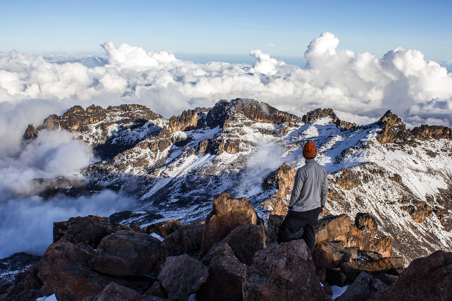
Figure 8. Top of Mount Kenya. ©Sergiu Jiduc, 2014
We woke up just before sunset, but to our surprise, the snowfall stopped, and the sun was shining. What happened remained an enigma for me. It was like a divine spectacle. Fantastic cloud formations danced beautifully with the static rock citadels. Alluring colours of red, orange, pink, yellow, blue-purple resulted from the sun setting behind “Point John” enchanted the small audience. I have not seen such a marvellous sunset before in my life, and this entire spectacle was just for us. We were alone with the Great Spirit of Ngai, on the second highest peak in East Africa, at the equator. But I have not felt alone; in fact, I have never felt so connected before. Mount Kenya has reset my spiritual antenna. We went to sleep rather “high” from this unique experience. Even the bitter cold of the night has not managed to change my positive mood.
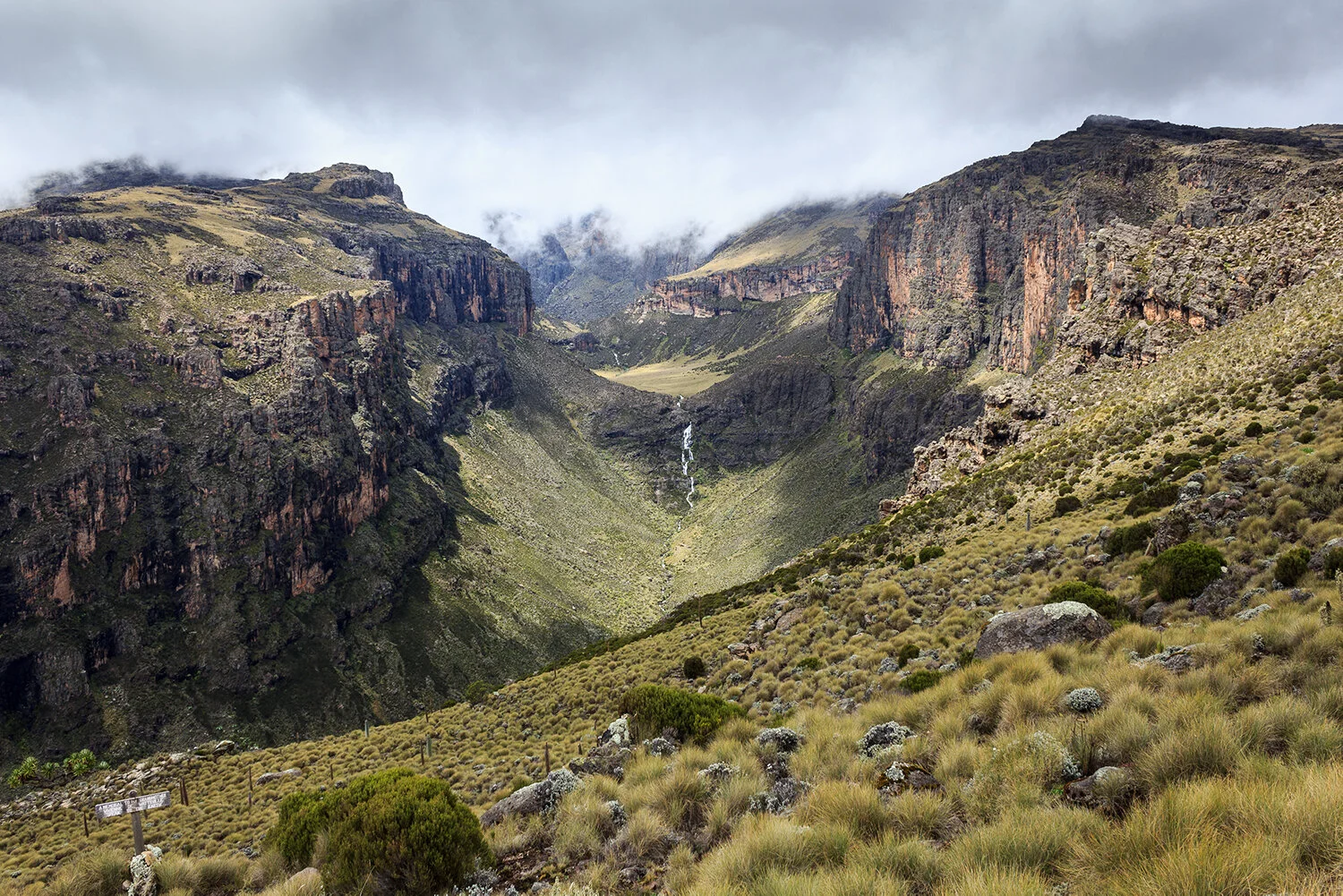
Figure 9. Chogoria Route, Mount Kenya. ©Sergiu Jiduc, 2014
Early in the morning, several groups of climbers woke us as they passed by our tent on their way to the summit. We packed the tent and descended with some of them towards Chogoria Valley, located in the east. The valley is probably the most spectacular approach to the main peaks, with beautiful views into the Gorges Valley. Many waterfalls, steep escarpments, bowl-shaped hollows filled with freshwater, and bizarre vegetation enchanted our long descent to Chogoria Gate. One of the guides we met hooked us up with a Land Rover driver who took us to Chogoria village, where we rented a taxi back to Nairobi. It took us four days to climb and descend the mountain. We did not use any porters for this ascent and had minimal trekking and camping gear. This ascent was a true success, crowned with a spectacular sunset